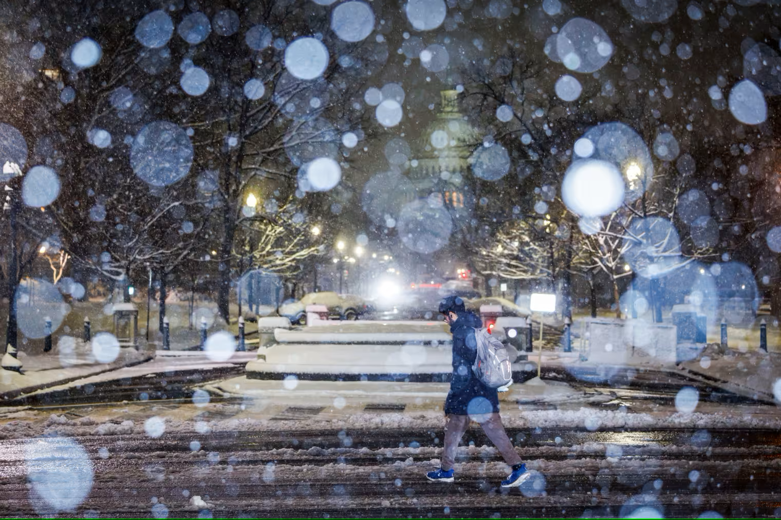
Winter weather brings snow and rain to both coasts with almost 100 million people under alerts
The National Weather Service warnings stretch from Colorado to Maine and multiple storms systems have dumped as much as 9 inches of snow in West Virginia.
Almost 100 million people are waking to winter weather alerts and warnings Wednesday morning, as storm systems cause severe conditions, biting cold and travel chaos from coast to coast.
The National Weather Service warnings stretch from Colorado to Maine; multiple storms systems have dumped as much as 9 inches of snow in West Virginia and disrupted planned confirmation hearings in Washington, D.C.
Back-to-back winter storms threaten to continue the icy conditions and snowfall over these regions in the next two days and a third storm is expected by the weekend. As much as 6 inches of snow could fall in Maryland, while New York City could get between 1 and 2 inches.
Heavy rain is drenching the South, from east Texas to southern Kentucky, raising the threat of localized flooding with 15 million people under flood alerts. Another 10 million people are at risk of possible tornadoes from Birmingham, Alabama, down to Baton Rouge, Louisiana. The storms Wednesday will likely create air travel delays in Atlanta, NBC's Al Roker said.
There have already been over 1,000 flight delays and more than 300 cancellations, mostly impacting the East Coast, within or in and out of the U.S. Wednesday morning, according to FlightAware.
The second storm system is already forming over eastern Colorado and the Plains and looks set to bring heavy snow to the Midwest and the Upper Midwest. This will spread snow from the central Plains into the Great Lakes on Wednesday — hitting Chicago around lunchtime — and into New England overnight, where it'll create ice and rain. All precipitation will be over by Thursday evening.
Snow falling at a rate of an inch an hour or more could create a hazardous evening commute, significant air travel delays and school closures Wednesday for big urban areas including Milwaukee; Chicago; Grand Rapids, Michigan; and Detroit.
Chicago is forecast to see 4 to 7 inches of snow through Thursday night, Detroit is forecast to get 4 to 6 inches, and Kansas City, Missouri, 3 to 6 inches.
The weather service office in Kansas City urged motorists to allow extra time and "use extreme caution" during Wednesday morning's commute, as heavy snow continues to fall. The Missouri Department of Transportation told drivers to avoid traveling at all where possible.
Early today, roads in Kansas City were already blanketed in snow that covered lane markings. Overnight, city officials activated a 400-person snow team to treat roads with salt. City Hall is closed Wednesday and Kansas City Public Schools and other nearby districts canceled school, as locals are urged to hunker down at home.
Similarly overnight in Madison, Wisconsin, Dane County Emergency Management and Highway & Transportation teams have been preparing snow plows.
“If you must travel please give yourself extra time to get where you are going, drive slowly, fasten your seatbelts and keep your distance from snowplows and other vehicles,” Dane County Executive Melissa Agard told NBC affiliate WMTV of Madison.
Meanwhile, California is braced for an atmospheric river event that could bring the state’s biggest winter storm of the season, with heavy rain threatening possible flooding and burn scars from recent wildfires heightening the risk of mudslides.
And the cold snap is expected to last through the workweek and reach further into the Lower 48.
The blast of Arctic air that has seen parts of North Dakota reach minus 55 degrees Fahrenheit this week, when the wind chill factor is added in, will move southward to the Ohio Valley and the central Appalachians by Friday, with temperatures 25 to 35 degrees below seasonal averages. An extreme cold warning is still in place in the northern Rockies and the northern Plains.
What the weather service called a "damaging freezing rain, ice event" will continue through Wednesday from northwest North Carolina to western Virginia, with 0.25 inches of ice expected, which could lead to dangerous road conditions.
The southern Plains, the lower Mississippi Valley and the Southeast will see heavy rain and possible thunderstorms and the risk of tornadoes Wednesday as moisture moves north from the Gulf of Mexico, which President Donald Trump has renamed the Gulf of America, the weather service warned. Local amounts of up to 6 inches of rain in the Mississippi River Valley is forecast through tomorrow night, Roker said.
The storms come after Tuesday’s winter storm saw 14.5 inches of snow fall in the Appalachian Mountains of West Virginia and Virginia, 6.5 inches fall at Atlantic City, New Jersey, 5.9 inches in parts of Washington D.C. and 1.5 inches at Central Park.
Burn scar debris fears in California
In California, 29 million people are already under flood watches ahead of heavy rain Wednesday night that could intensify into Thursday. A moderate risk for flooding is in place for southern California Thursday through Friday morning.
There, 1 to 3 inches of rain will be possible across coastal areas, with 6-10 inches possible in the mountains and foothills.
The weather service said there was a moderate risk of severe rainfall over parts of Southern California on Thursday, amid fears that rainfall could reach 1 inch per hour, with heavy snow falling in the mountain ranges. "Numerous flash flooding events are possible," the agency said.
Gov. Gavin Newsom ordered a statewide response in advance of the coming storm — including the use of protective materials to contain burn scar debris from the Palisades and the Eaton fires entering creeks and rivers.
"The incoming storm could bring an increased risk of power outages, flooding in small streams and low-lying areas, and debris, rocks and mudslides on roadways," the state said in an update Tuesday night.
Concrete barriers known as K-rails, 319,00 sandbags and 5,600 co-called "super sacks" have been placed across Southern California to make protective walls stretching nearly 120 miles in total, and there has already been work to remove some debris in the last month, the state government said. Some 242 fire engines are already deployed, as well as 400 personnel in eight counties, five helicopters and 70 soldiers.
The state has also employed 14 geologists to study and map the burn scars to better understand possible debris flow.
The Pacific Northwest is not spared the winter onslaught and will experience coastal rain and snow in the higher elevations Thursday, as snow affects much of the Western states.
 313
313


